Coos Head Area Master Plan (CHAMP)
Project Description
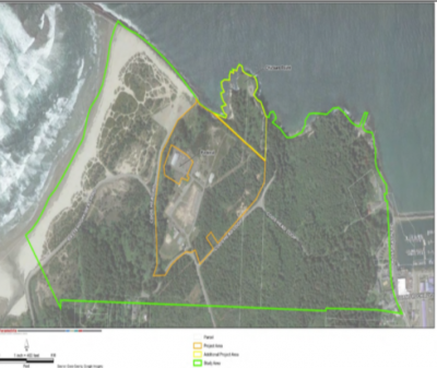
The Coos Head Area Master will be adopted as part of the Coos County Comprehensive Plan and amendments will be made to the Coos County Zoning and Land Development Ordinance in order to implement the 2018 Coos Head Area Master Plan (CHAMP). The CHAMP establishes a development plan for Coos Head, consisting of an interpretive center, conference center and hotel, tribal center, and potentially recreational vehicle and tent camping.
Both this implementation project, and the original CHAMP, are funded by the State of Oregon's Transportation and Growth Management Program (TGM). The TGM Program is a joint effort of Oregon's Department of Transportation and Department of Land Conservation and Development. The goals of TGM are to help local governments integrate transportation and land use planning, and to encourage efficient use of land and resources; human-scaled, walkable communities; good connections between local destinations; and pedestrian, bicycle, and transit-oriented development.
Background:
Coos Head is in Coos County on a bluff overlooking the Pacific Ocean and the mouth of Coos Bay and is the homeland of the Miluk Coos Indian Tribe. In 1875, this land was taken by the U.S. government. From 1958 to 1995, Coos Head was a naval facility that contributed significantly to the economy of the Coos Bay region, and in 2005, the Bureau of Indian Affairs (BIA) restored this site to the Confederated Tribes of Coos, Lower Umpqua and Siuslaw Indians (CTCLUSI). Altought owned by CTCLUSI, Coos Head is currently subject to County and State land use regulations.
The CHAMP planning process was funded as a TGM grant for the purpose of creating a plan to redevelop the former military site on Coos Head for tourism, economic development, cultural activities, and to restore the site to use by and for the benefit of CTCLUSI now that they have reclaimed this portion of their ancestral lands.
Due to the fact the site is still subject to state and local land use regulations, including the Coos County Comprehensive Plan and Ordinance, both documents must be amended in order to implement the CHAMP. The Project Area is zoned as Forest and Conservation Shorelands. A new zone or overlay zone will be needed to allow the development planned for in the CHAMP. The CHAMP considered three different land use alternatives: a) development focus, b) mixed focus, and c) tribal focus. Ultimately, the planning process resulted in Alternative A (development focus) being selected as the preferred alternative. Alternative A recommends the most employment uses (conference center & hotel), but has limited housing. However, CTCLUSI’s application for this Project expresses support for the possibility of allowing more residential use than is currently anticipated by the CHAMP, in order to promote a complete community with a good jobs-housing balance.
Project Notification List :
If you would like to receive updates on the plan please send an email to planning@co.coos.or.us or call Coos County Community Development, Planning Department at 541-396-7770 and request to be added to the notification list.
Project Team
The county staff that is part of the project team for the CHAMP consists of: Leslie Carroll, Permit Tech; Crystal Orr, Associated Planner; and Jill Rolfe, Director. The team may be contacted by calling 541-396-7770 or emailing planning@co.coos.or.us .
Updates:
Please make sure to check back with us for project updates.

