Surveyor
Michael L. Dado, Coos County Surveyor
Tamara Smith, Business Operations Manager
250 N. Baxter
Coquille, Oregon 97423
Phone: 541-396-7585, 541-396-7586, 541-396-7587
Email: coossurvey@co.coos.or.us
Coos County Surveyor
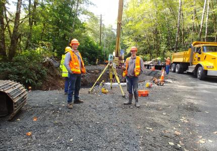
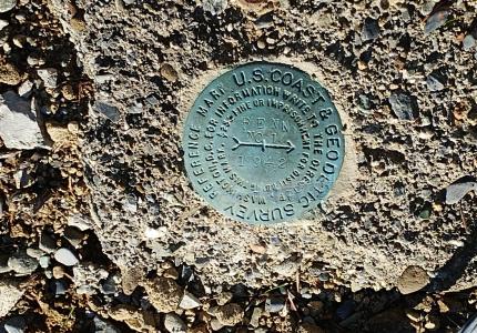
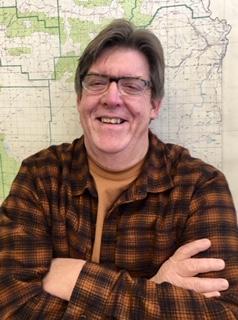
Michael L. Dado is the elected Coos County Surveyor. Before being elected to office Mike was a private surveyor in Coos County Oregon for over 40 years. Mike has a passion for his work, enjoys helping the public and researching our county records. He enjoys educating the community with the services our office provides and how it can benefit members of our county. The office of the County Surveyor is responsible for checking, filing and indexing boundary surveys by private and public surveyors, we also maintain all records of surveys and provides means by which the public can use these records. The Surveyor checks and approves subdivisions, land partitions, property line adjustments and condominiums, as well as surveying county owned land and roads. The Surveyor is responsible for the recovery, restoration and preservation of public land corners; i.e. section corners, quarter corners and donation land claim corners. In addition to being the Coos County Surveyor, Mike is also the Coos County Land Agent. That service involves working with Tax Foreclosed Properties, cleaning them, tearing them down, getting them ready for auction and hosting our annual auction.
When Mike is not at work, he is usually writing music, playing guitar/banjo or singing in his band Caught Red Handed. He loves living on the Oregon Coast, you might see him at the beach, around town or up on stage, make sure to say hello.
Documents Available in the Surveyor Office are: